Havasu Falls
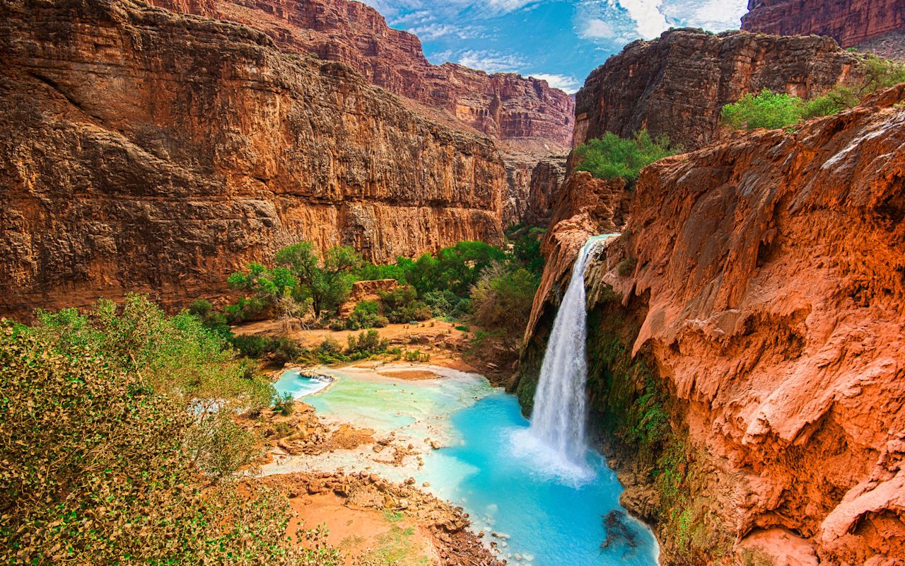
A series of beautiful and photogenic waterfalls can be found on Havasu Creek, a tributary to the Grand Canyon. The water flows out of limestone, which gives it a pleasing blue-green hue. The waterfalls have created large plunge pools that are clear, deep and inviting. People come from around the world to view the waterfalls and Grand Canyon scenery, and swim in the pools.
The area is part of the Havasupai Indian Reservation and is managed by the tribe. The number of visitors is restricted and reservations are required. See the tribe's website for contact numbers and info about making reservations. You must apply for reservations months in advance for trips during the tourism season.
When To Go
May/June and September/October are the best months to visit if you want to play in the water. Hiking conditions are excellent in the earlier spring and later fall, but the water will be cold and less inviting. The water is delightful during mid-summer but hiking conditions are hot.
Getting There
You must hike/backpack or ride horses to reach the waterfalls. From the trailhead it is 8 miles to the Havasupai village of Supai, where you check in at the tourism office. You can also buy basic supplies, food and drinks in the village.
Havasu Falls is located 2 miles below the village. Mooney Falls is a mile further down the trail. A campground can be found along the stream between those two waterfalls. Most tourists camp but some elect to stay in the lodge in the village. The village also offers a small cafe.
All supplies brought into the village and campground come by backpacking, mule train or helicopter. The village receives mail by mule train. Because of its remote location, supplies in the village are more expensive than similar items at your local grocery store.
What To Expect
The 10 mile trail from the trailhead to the campground is steep, particularly on the upper end. It is also rocky and in some spots it is fully exposed to the summer sun. Backpacking here is strenuous. Many visitors elect to have their packs carried in by mule trail. Some pack in but then have the mules carry their gear out.
The trailhead is called Hualapai Hilltop. It is located at the end of Indian Road 18, 60 miles north of the Junction of Road 18 and Hyw 66. The junction is between Seligman and Peach Springs, in northwest Arizona. This is a remote area about 235 miles east of Las Vegas, or about 165 miles northwest of Flagstaff, AZ. Some computer/internet map programs show alternate routes to the Hilltop but those are rugged backroads not recommended for automobile travel. Indian Road 18 provides the best access.
Havasu Falls | Photo Gallery


Havasupai Falls and blue pools
REQUEST INFORMATION
TRAVEL BUREAU INFORMATION
Kane County Office of Tourism
78 South 100 East
Kanab, UT 84741
435-644-5033
Location
Get DirectionsGrand Canyon Weather
Average Temperature
Average Precipitation
Average Snowfall
Articles
View AllTop 10 Waterfall Hikes in Utah
Utah's mountains are home to beautiful waterfalls. Take a look at our list of the top 10 waterfall h...
10 Best Easy Hikes in Utah
Utah's mountains and deserts create some of the world's best hiking areas. Read this list to find th...
Top 5 Wildflower Hikes in Utah
Find the best hikes and areas to view wildflowers in Utah this summer. Read on to see the best five ...
Breathtaking but Deadly: How to Safely Hike Angels Landing
Angels Landing is famous for its beauty and danger. Utah.com has tips for making your climb thrillin...