Bonneville Salt Flats
Imagine a place so flat you seem to see the curvature of the planet, so barren not even the simplest life forms can exist.
Imagine the passing thunder of strange vehicles hurtling by on a vast dazzling white plain. This is not an alien world far from earth; it is Utah's famous Bonneville Salt Flats.
Click here to learn more about speed events at the Salt Flats.
Video by drone filmmaker @TappChannel | Follow on Instagram: tapp_channel
Read more…
Promotional Links
Unusual Features
Bonneville Salt Flats has one of the most unique natural features in Utah: A crust of salt stretching over 30,000 acres. Looking out across the area, you’d swear there was a light dusting of snow, even in the middle of summer. Despite its impressive looks, it’s speed that brings the Flats international recognition.
Where are the Bonneville Salt Flats?
Directions to the Bonneville Salt Flats are simple: From Salt Lake City, hop on I-80 and head west. On your way, you’ll pass the Great Salt Lake, an 87-foot stone tree and miles and miles of mostly barren land.
Things to See and Do
Racing
The famous Bonneville Speedway, where amateur racers go to break land speed records, is located in the northwestern portion of the recreation management area. The salt fields are perfectly flat, making it the ideal place to see just how fast an experimental vehicle can go. Imagine driving across a frozen lake bed, only instead of ice it’s made of the stuff you sprinkle on your french fries.
The land is flat for miles and miles.
Landscape
Beyond the Bonneville Salt Flats, low mountains and hills break up the horizontal landscape. There is a bit of vegetation on the hillsides which tries to encroach into the flat areas, but it doesn’t get far. And on hot days, heat waves rise from the salty soil to create mirages so real, you could easily convince yourself the desert is instead a giant lake.
Best Point of View
You’ll get the best viewpoint of the area from the Salt Flats Rest Area near milepost 10. Park your car and take a walk out onto the salty soil for a most satisfying crunch. Tread carefully, though, especially if you’re wearing sandals; those jagged crystals can be sharp. When you return, clean your shoes off at the wash station — unless you want to vividly remember your visit for years to come.
At the Salt Flats Rest Area, you can walk out onto the salty soil.
Nearby Attractions
If thinking about all that Bonneville salt is making you thirsty, the split town of Wendover — Utah and Nevada share the border town name ��— is just up the road. Stop in for some refreshment. Utah’s side can serve you soft drinks, Nevada has the harder stuff.
Geology
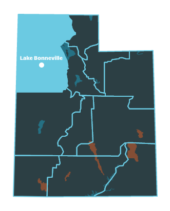
Where did all that salt come from? The Salt Flats were formed when ancient Lake Bonneville, which once covered one-third of Utah, dried up. The Great Salt Lake is a mere remnant. Today, the flats include a variety of micro environments, including ponds and marshy areas near the edges of the flats. These spots are critical habitat for some plants and animals.
Mountains in the far distance break up the barren landscape.
Bonneville Salt Flats | Photo Gallery


Tree of Utah sculpture by Karl Momen
About Your Visit
The Bonneville Salt Flats is administered by the Bureau of Land Management. Due to its unique geology, history and scenic beauty, it was designated an Area of Critical Environmental Concern in 1985.
Act Responsibly
Despite its crusty surface, the Bonneville Salt Flats has a fragile environment. Please drive only on established roads, as any off-roading can damage the delicate soil underneath the salt. No driving on the flats is permitted when the area is wet or flooded.
Day-use Only
No camping or overnight stays are permitted on the salt fields, but you may camp on surrounding public lands. Find private campgrounds and hookups in nearby Wendover, as well as other accommodations and services.
There are no facilities or services on the salt flats, so plan ahead. Temporary facilities are available during racing events.
Coarse Conditions
Note that the salt water is highly corrosive and can short-out the electrical system in your vehicle. Also, be prepared for desert conditions. Temperatures can exceed 100 degrees Fahrenheit in the summer and drop well below 0 in the winter.
Military Testing
The federal government owns nearly all of the land in this area. Large portions are used by the military as storage depots, testing areas and bombing ranges; the crew who dropped the atom bomb in 1945 trained here. These sections are fenced and marked, and public access is prohibited.
Bonneville Salt Flats Events
People come from all over the world to Bonneville Salt Flats for land speed racing events.
Read an overview of Speed Events at the Bonneville Salt Flats in this article : Think You Know Fast? Not Until You Experience Bonneville Salt Flats Speed Events
Location
Get DirectionsTHINGS TO DO NEARBY
Things to Do in Salt Lake City
View AllThink You Know Fast? Not Until You Experience Bonneville Salt Flats Speed Events
A flat bed of pristine, crunchy salt is the perfect surface to set land speed records. Just ask the ...
The Best Ways to See a Concert at Salt Lake City Music Venues
Interested in upcoming concerts in Salt Lake City? Utah.com has you covered with all the best ways t...
Utah's Top 5 Places You Don't Think About
Zion, Arches, Bryce...Been There. Done That. Here are the other outdoor Utah playgrounds you should ...
City Creek Center – Shopping Elevated
City Creek Mall offers some of the best shopping in Salt Lake City. Check out the different stores a...
Red Butte Garden releases outdoor concert series lineup. Here's who is coming
This year's Red Butte Garden Outdoor Concert Series lineup features some big names and artists retur...
12 Family Friendly Winter Activities in Utah
Feeling cooped up? Try these indoor and outdoor winter activities for kids and parents alike. Utah i...
Urban Wall Crawl: Murals in Salt Lake City
Street art is everywhere in Utah’s capital. Discover where some of the biggest, boldest murals are f...
10 of the Most Bizarre Places in Utah
Utah is home to some bizarre and beautiful places. Check out our list of spooky, artsy and out-of-th...
Wendover Weather
Average Temperature
Average Precipitation
Average Snowfall
Articles
View AllThink You Know Fast? Not Until You Experience Bonneville Salt Flats Speed Events
A flat bed of pristine, crunchy salt is the perfect surface to set land speed records. Just ask the ...
Happy Trails in Piute County
What do Delano Peak, the Paiute ATV trail and Butch Cassidy all have in common? Utah’s Piute County,...
8 Secrets to Sustainable Travel in Park City
Want a big adventure to Park City without a big environmental footprint? Utah.com can help you explo...
Natural Bridges National Monument: A Hidden Gem, Not a Second Fiddle
An under the radar destination that should be on your radar. Learn all about Natural Bridges, Utah a...
Treat Yourself to a (San Rafael) Swell Winter
The San Rafael Swell is one of Utah’s hidden gems, and it gets even more hidden in the winter. Utah....
Plan a Triathlon of Fun in Greater Zion
Looking for things to do in St. George this fall? In addition to the IRONMAN 70.3 World Championship...
Color Me (Insert Emotion Here): Where to See Cedar City’s Feel-Good Fall Foliage
Richly hued views await you in southern Utah this autumn. Peep the changing leaves on a scenic drive...
Play Outside and See a Play Outside in Cedar City
Take a visit to Cedar City, Utah, and see why its access to both world class theater and stunning ou...
Mapping Out Utah’s Tastiest Cuisine
Getting to know the Beehive State means experiencing its sites and unique flavors. Discover both whe...
Get Your Peach Thrills in Box Elder County
Utah’s Box Elder county is a peachy paradise — part mountain range, part desert, part orchard and al...
9 Highest Peaks Across Utah
Take a peek at the tallest peaks in Utah. From Kings Peak to the Deep Creeks, Utah.com gets to the t...
Paving the Way for Everyone: All-Access Trails in Utah
From a wheelchair accessible waterfall trail to a lakeside boardwalk laden with wildflowers, these U...
Local Legends in Utah
Ever been curious about urban legends in Utah? Utah.com fills you in all things folklore with our gu...